GEOTECHNICALENGINEERING1
ADELAIDE
HomeUnderground ExcavationsGeotechnical excavation monitoring

Geotechnical Excavation Monitoring in Adelaide: Real-Time Data for Safer Cuts

Site investigations you can build on.

LEARN MORE

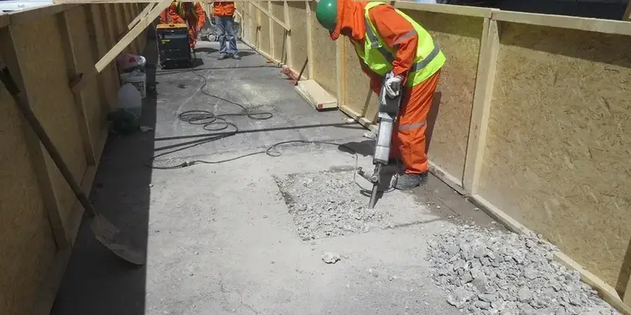
Adelaide sits on a complex geological fringe where the faulted bedrock of the Mount Lofty Ranges transitions abruptly into the Quaternary alluvium of the plains. Excavation depths across the CBD often exceed 15 metres for multi-level basements, and the city’s history of moderate seismicity—most recently recorded in the 1954 Adelaide earthquake—means that shoring design is never a static calculation. Our monitoring service deploys instrument arrays that track lateral displacement, groundwater response, and anchor load variation in real time, giving the project team hard numbers instead of assumptions. When a cut is advancing through fractured siltstone one day and saturated Keswick Clay the next, the deep excavation instrumentation strategy needs to adapt to the ground, not the other way around. From North Terrace to Tonsley, we integrate automated total stations with manual verification points so the data stream remains reliable even when site conditions get messy.

Monitoring is not about recording what happened—it is about catching the trend before it becomes a failure.

Our service areas

How we work

One mistake we see repeatedly on Adelaide sites is treating monitoring as a tick-box exercise: install a few inclinometer casings, take weekly readings, and file the report. That approach misses the point entirely. A retaining wall on Pirie Street behaves differently when the adjacent building is a 1920s masonry structure versus a modern concrete frame; deflection thresholds that are safe for one can be catastrophic for the other. Our methodology starts with a deformation model specific to the excavation sequence and the stiffness of the support system—soldier piles, secant piles, or soil nails—then sets trigger levels at 50%, 75%, and 90% of predicted movement. Readings are processed through NATA-accredited laboratory calibration protocols so that every micrometre of movement reported has a traceable chain of accuracy. The instrumentation package is tailored to the ground profile: in the Hindmarsh Clay basin we emphasise piezometers and settlement arrays; in the fractured quartzite of the Mitcham foothills, crack meters and load cells become the priority. Data lands on the engineer’s dashboard within hours, not days, because a Friday-afternoon anomaly cannot wait until Monday morning.
Geotechnical Excavation Monitoring in Adelaide: Real-Time Data for Safer Cuts
Technical reference — Adelaide

Local geotechnical context

A vibrating-wire piezometer buried in a borehole off Gouger Street looks unremarkable—a slim stainless-steel cylinder with a signal cable—but it is the quiet sentinel that catches pore-pressure buildup before the base of the excavation heaves. In Adelaide’s Western Suburbs, where groundwater sits barely three metres below street level, a single unmonitored dewatering failure can flood a basement excavation in under an hour. The risk cascade moves fast: excess pore pressure softens the toe of the shoring wall, the wall rotates, the street above settles, and suddenly you are managing a third-party damage claim while the project clock ticks. We combine standpipe and automated piezometers with surface settlement points laid out in a grid extending at least two times the excavation depth from the perimeter, because the zone of influence in soft ground does not respect property boundaries. Threshold exceedance triggers an immediate SMS alert to the site manager and the design engineer, with a clear escalation protocol that removes hesitation when decisions are urgent.

Need a geotechnical assessment?

Reply within 24h.

Email: contact@geotechnicalengineering1.co

Relevant standards

AS 4678–2002 Earth-retaining structures, AS 1726–2017 Geotechnical site investigations, AS/NZS 1170.0:2002 Structural design actions – General principles, NATA calibration traceability to ISO 7500-1 for load measurement

Typical values

ParameterTypical value
Inclinometer casing depth range5–50 m, grouted into bedrock
Typical reading frequency (active phase)Daily to twice-weekly
Trigger level frameworkAlert (50%), Action (75%), Emergency (90%)
Total station accuracy±1 mm + 1 ppm over baseline
Load cell calibration standardNATA traceable to ISO 7500-1
Data delivery formatWeb dashboard with automated PDF reports
Applicable Australian standardAS 4678–2002 Earth-retaining structures

Quick answers

How much does geotechnical excavation monitoring cost for a typical Adelaide basement project?

For a standard commercial basement excavation in the Adelaide CBD or inner suburbs, monitoring programmes typically range from AU$1,200 to AU$3,980 depending on the number of instrument stations, reading frequency, and reporting requirements. A basic package with inclinometers and settlement points costs less than a full suite with automated piezometers and load cells. We provide a fixed-scope quote after reviewing the shoring design and the adjacent asset register.

What trigger levels should be set for an excavation next to a heritage building in Adelaide?

Heritage structures—common along King William Street and North Terrace—require tighter thresholds than modern buildings. We typically set the alert trigger at 5–8 mm of lateral movement or 1:500 angular distortion, whichever is reached first. The action trigger sits at 10–12 mm, and emergency protocols activate at 15 mm. These values are calibrated against the building's construction type: unreinforced masonry demands more conservative limits than a steel-framed structure.

How often should monitoring readings be taken during bulk excavation?

During active excavation and dewatering, we recommend daily readings on all inclinometers and piezometers within the primary influence zone. Settlement points can be read every 48 hours unless they are within 10 metres of the shoring wall, where daily readings apply. Once excavation reaches formation level and the permanent structure begins to rise, frequency can step down to twice-weekly, then weekly during post-construction surveillance.

Does AS 4678 require continuous monitoring for all excavations?

AS 4678 does not mandate continuous monitoring for every excavation; the required intensity is risk-based. Excavations deeper than 6 metres, those within a distance less than twice the excavation depth from sensitive structures, and cuts in soft ground with high groundwater all trigger Category 2 or Category 3 monitoring regimes, which effectively require near-continuous data collection during critical phases. The standard places the onus on the design engineer to specify the monitoring plan, and our role is to execute it with calibrated instrumentation and auditable reporting.

Location and service area

We serve projects in Adelaide and surrounding areas.

View larger map